
Il progetto 3D City Model – Digital Twin lavora allo sviluppo di studi relativi ai modelli urbani digitali del progetto DOUT – Digital Open Urban Twin (2018-2019). Lo scopo, nella linea guida del DOUT, è quello di studiare l’approccio metodologico integrato per la generazione di una piattaforma di dati aperta per raccogliere, integrare e gestire dati e informazioni su scala urbana e simulare le azioni e gli effetti delle politiche sulle città. La fase preliminare della ricerca ha comportato l’esplorazione di piattaforme di modellazione dei dati su scala urbana orientate al BIM-GIS e la loro adattabilità e conformità ai principi di standardizzazione e interoperabilità (ad esempio 3DS-Dassault Systèmes 3D experience). Il progetto lavora anche all’implementazione di un approccio metodologico e di un processo tecnologico per strutturare una banca dati spaziale basata sul caso studio della città di Torino. Questo modello 3D della città è concepito come un concetto innovativo di Digital Twin, ovvero una replica digitale della città, in grado non solo di riprodurre le condizioni fisiche esistenti, ma anche di integrare aspetti morfologici e semantici e, in futuro, di implementare algoritmi di previsione in grado di formulare ipotesi sugli effetti delle dinamiche e delle politiche urbane.
Nell’ambito degli studi urbani che analizzano i fenomeni e i processi di trasformazione della città odierna a fini di pianificazione e progettazione, l’approccio multidisciplinare rappresenta una sfida enorme. La possibilità di beneficiare di una rappresentazione tridimensionale avanzata della realtà, che vada oltre le tradizionali mappe 2D, fornisce un’analisi spaziale avanzata su scala urbana per lo studio dei fenomeni socio-economici che guidano la rigenerazione urbana.
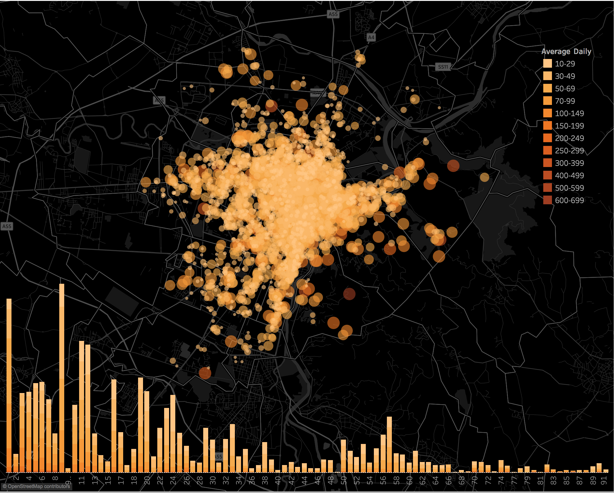
Per analizzare e monitorare queste dinamiche, è essenziale disporre di strumenti geospaziali che gestiscano i dati geografici, sotto forma di cartografia numerica e modelli 3D, consentendo l’identificazione e la quantificazione delle trasformazioni urbane e di qualsiasi area che necessiti di ulteriori interventi di rigenerazione urbana, al fine di attuare azioni localizzate, preservando il patrimonio edilizio della città. Per questo motivo, gli strumenti di acquisizione, le tecniche di misurazione e i prodotti multisorgente e multicontento derivati dagli approcci geomatici costituiscono un valido supporto per l’analisi e la modellizzazione del patrimonio urbano e dello spazio costruito, nonché dei fenomeni umani che costituiscono la città.
La ricerca geomatica applicata alla modellizzazione urbana viene utilizzata per studiare questioni relative al concetto di modelli urbani 3D negli ultimi 10 anni. L’attuale prospettiva di questa ricerca è la possibilità di modellizzare non solo informazioni 3D e semantiche degli oggetti urbani, ma anche informazioni multidimensionali, in particolare relative alla risoluzione temporale passata, al fine di simulare il comportamento futuro. Infatti, negli ultimi anni, i concetti di modello urbano 3D e Digital Twin sono diventati sempre più rilevanti, non solo nel campo della geomatica, ma anche in vari campi di ricerca, come la pianificazione urbana, le attività di rigenerazione urbana nel campo dei beni culturali e poi nel monitoraggio dei processi di trasformazione delle città. Attualmente, la ricerca è ancora lontana dall’essere risolta ed è rappresentata dall’integrazione di standard, formati e tecniche di modellazione adottati dai sistemi di analisi regionale GIS (incentrati sulla produzione di mappe numeriche regionali) e dai database BIM e HBIM (fondamentali per la modellazione parametrica relazionale 3D su scala architettonica). Sarà quindi fondamentale gestire e adottare diverse fonti di dati all’interno di piattaforme in grado di gestirne e testarne la flessibilità per una possibile integrazione all’interno di un unico database geografico relazionale, strutturato e multi-contenuto/multi-scala.
Gli argomenti che il progetto di ricerca 3D City Model – Digital Twin tratterà progressivamente, in un’analisi interdisciplinare relativa alla progettazione e alla struttura dei modelli urbani 3D, sono: il problema geometrico, il problema semantico, il problema delle relazioni e il problema dei contenuti tematici.
Sulla base di questi presupposti, partendo dall’analisi degli standard (preferibilmente con approccio open source), dei dati geospaziali strutturati, degli strumenti e delle metodologie oggi disponibili, il progetto si concentra sulla definizione di un codice di modellazione urbana per uno strumento di progettazione e pianificazione in grado di supportare i processi decisionali locali, nella forma di un database geografico 3D (.gdb) adatto ad ospitare dati tematici complessi e interconnessi (sul patrimonio costruito, sui consumi energetici, sugli studi acustici, sulle analisi del traffico, sulle informazioni sul terreno, ecc.). Ciò viene condotto con particolare attenzione a una possibile definizione, attraverso il supporto di operazioni di geo-processing, di un modello in grado di rilevare e identificare i diversi livelli di ciascuna entità edilizia (derivato dalla cartografia strutturata dell’infrastruttura di dati spaziali implementata e aggiornata).
L’obiettivo della ricerca è quindi quello di sviluppare un modello di città 3D strutturato geometricamente e semanticamente relativo al comune di Torino, sulla base di regole spaziali parametriche definite ad hoc e in grado di rappresentare i fenomeni urbani, modellare le stratificazioni storiche della città e valutare come questi strati possano interagire all’interno di un ambiente di modellazione tridimensionale al fine di replicare il passato e simulare scenari di trasformazione e sostenibilità futuri attraverso l’adozione di piattaforme dedicate alla simulazione urbana.
Questa prima fase della ricerca si è sviluppata in tre direzioni specifiche:
- 1- DATI. Raccolta, armonizzazione e aggiornamento di dataset geografici e dati tematici disponibili sulla città di Torino (indice di metadati COMPLETO) per la strutturazione di un database geografico multiscala e multicontenuto. Sperimentazione di acquisizione ed elaborazione di dati da sistemi di mappatura mobile a scala urbana. Raccolta e utilizzo di dataset multitemporali sulla città di Torino mediante dataset aerofotogrammetrici storici e conseguente correlazione di DSM multitemporali per il rilevamento e la valutazione delle trasformazioni urbane (Abate et al., 2019).
- 2- MODELLI 3D. Trattamento di dati Lidar/fotogrammetrici aerei in forma di DSM raster/vettoriali per l’integrazione di informazioni relative alla forma e all’andamento dei tetti. Studio di strumenti GIS-BIM in grado di gestire la modellazione multiscala e di garantire una crescente interoperabilità tra i due sistemi e i relativi linguaggi e standard. Generazione di modelli 3D semplificati con contenuto semantico e con struttura informativa ottimizzata a livello del suolo (vedere il progetto ROCK e il relativo Rapporto Tecnico).
- 3- VISUALIZZAZIONE. Sviluppo e ottimizzazione di strumenti di analisi spaziale e strategie di rappresentazione dei dati attraverso la visualizzazione spaziale 2D, 2.5D e 3D (progetto ROCK).
Pubblicazioni
- Abbate, E., Sammartano, G., & Spanò, A. (2019). Prospective upon multi-source urban scale data for 3D documentation and monitoring of urban legacies. ISPRS – International Archives of the Photogrammetry, Remote Sensing and Spatial Information Sciences, XLII-2/W11, 11–19. https://doi.org/10.5194/isprs-archives-XLII-2-W11-11-2019
- Colucci, E.; Mantello, F.; Spanò, A.; Sammartano, G.; Abbate, E. (2019). Approcci GIS ed HBIM integrati per l’analisi del patrimonio paesaggistico. 23a Conferenza nazionale ASITA, 12-14 November 2019, Trieste (Italy)
- Technical Report “Which digital tools for the creation of a Digital Open Urban Twin?”, progetto di ricerca DOUT (Digital Open Urban Twin) resp. Antonio Vetrò
- Technical Report Progetto ROCK “Mappatura e analisi di proprietà e aree dismesse a Torino nell’ambito del progetto europeo ROCK – Regeneration and Optimization of Cultural Heritage in Creative and Knowledge cities (GA 730280) finanziato dal programma Horizon2020 – CIG: Z78280839F”. Intermedio 26/11/2019. Finale 06/2020
